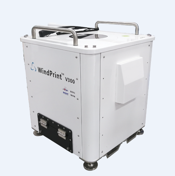
WindPrint V300 Wind Profile Lidar (onshore)
Wind Profile Lidar – Wind lidar for vertical profile meets the IEC 61400-12-1 standard of wind measurement. It is the economic equipment choice of wind measurements for the power curve determination and estimation, wind farm Operation and maintenance, pre-evaluation, initial site assessment.
Wind Profile Lidar employs the Doppler Beam Swinging (DBS) configuration which can probe the wind speed and direction profile from 30m to 240m (up to 300m). The Lidar system can capture wind profile in a very high spatial(≤0.1m/s) and temporal resolution(1s data sampling rate).
Wind Profile Lidar is portable, unsupervised and no electromagnetic interference.The techniques can operate in harsh environment.
● To capture real-time wake effects turbine-to-turbine, wind profile and turbulence from ground to the whole rotor disc with high spatial and temporal resolution
● To display wind variations instantaneously with high speed data sampling rate
● Unattended and continuous operations in harsh mountainous regions
● Eyes safety, ultra-portable, lower power consumption, quick launch, easy operation
● Modularization design for different platforms, buoy and vehicle-mounted
pecifications:
|
Model |
Wind Profile Lidar |
|
Detection range |
30m ~ 300m |
|
Data update |
1s |
|
Range resolution |
measure the wind speed at 20 different heights from 30m to 300m |
|
Wind speed accuracy |
≤0.1m/s |
|
Wind speed range |
0 ~ 75m/s |
|
Wind direction accuracy |
0.1° |
|
Scanning configuration |
DBS |
|
Power supply |
AC 220V/ 50Hz or DC 12V/24V |
|
Power consumption |
90W 150W when cooling at 40℃ |
|
Operating temperature |
-30 ~ +50 ℃ |
|
Operating humidity |
0 ~ 100% |
|
Housing classification |
IP65 |
|
LASER Safety Compliance |
1M IEC/EN 60825-1(eyes safety) |
|
Weight |
System 45kg |
|
Data transfer |
Ethernet 1000Base-T GPRS (optional) WIFI |
|
Output data |
? 1s horizontal, vertical wind speed & direction ? 10 min horizontal, vertical wind speed & direction ? Min & max wind speed ? Horizontal & vertical wind speed standard deviation ? Signal to Noise Ratio (SNR) ? GPS coordinates, time ? The temperature, humidity, pressure, monitoring of lidar system |


